Tongariro Alpine Crossing

Tongariro Alpine Crossing

My most recent hike in the context of my world tour in New Zealand was designated by many as the most beautiful day hike in the world Tongariro Alpine Crossing.

World Travel tongarito crossing

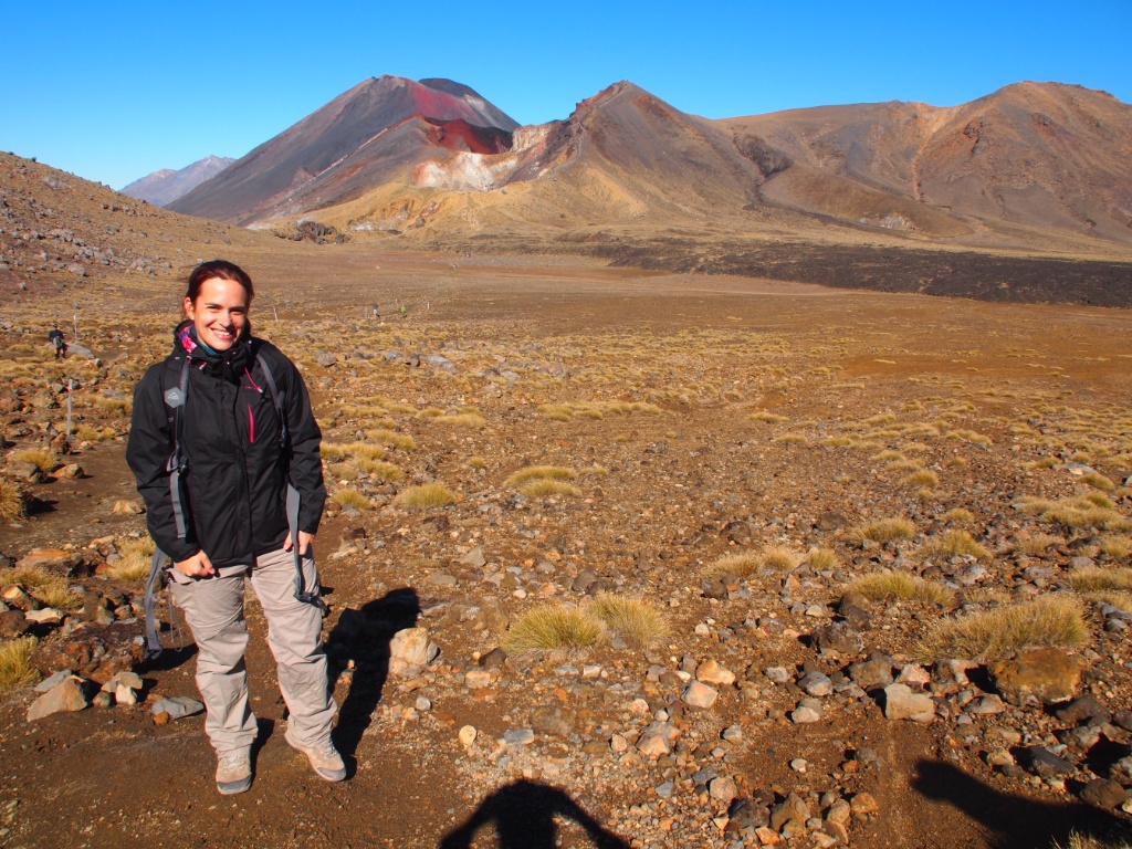
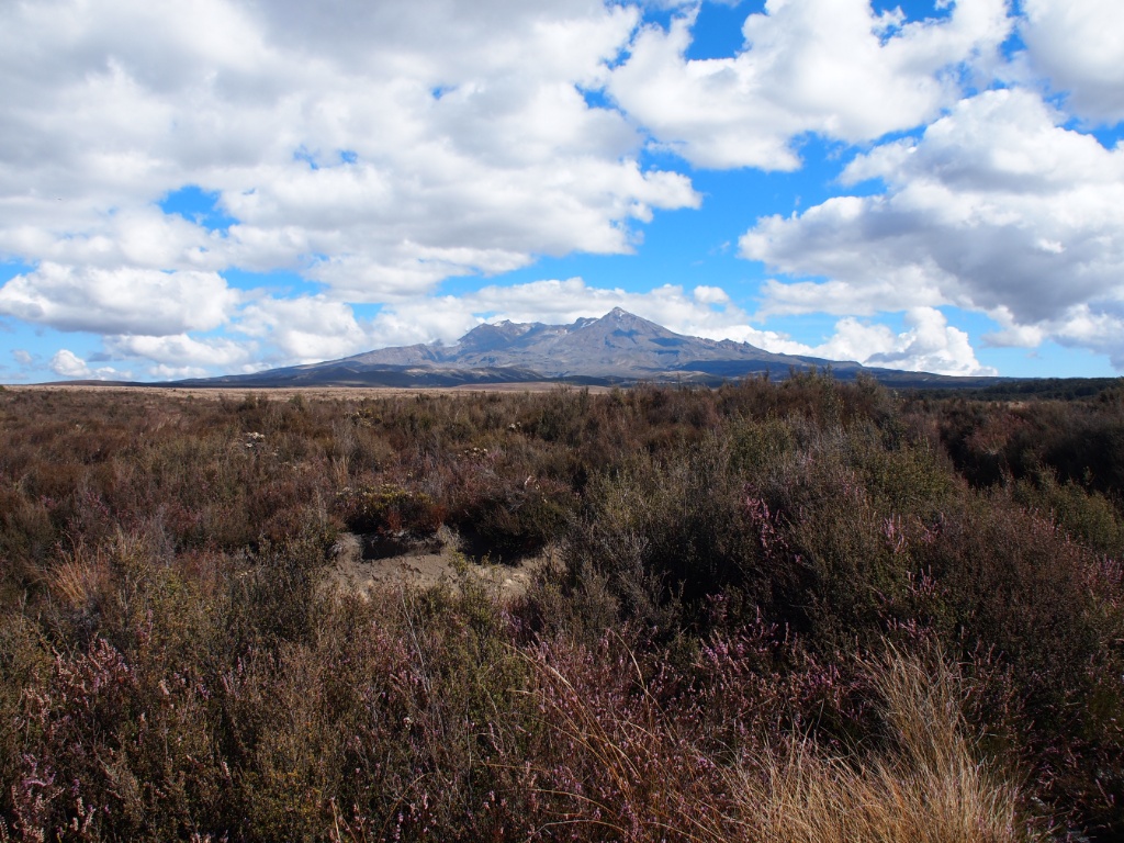
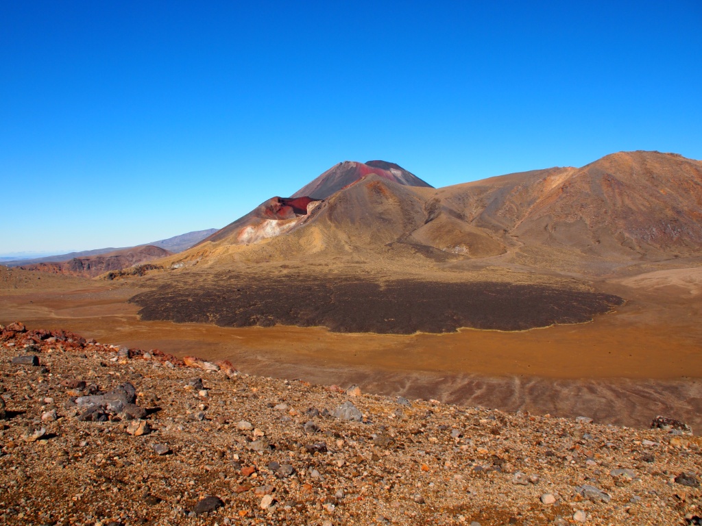
Again, I was very lucky with the weather, so the day before I had a very nice view of the undemanding mountain massif in Tongariro National Park.

Tongariro national park

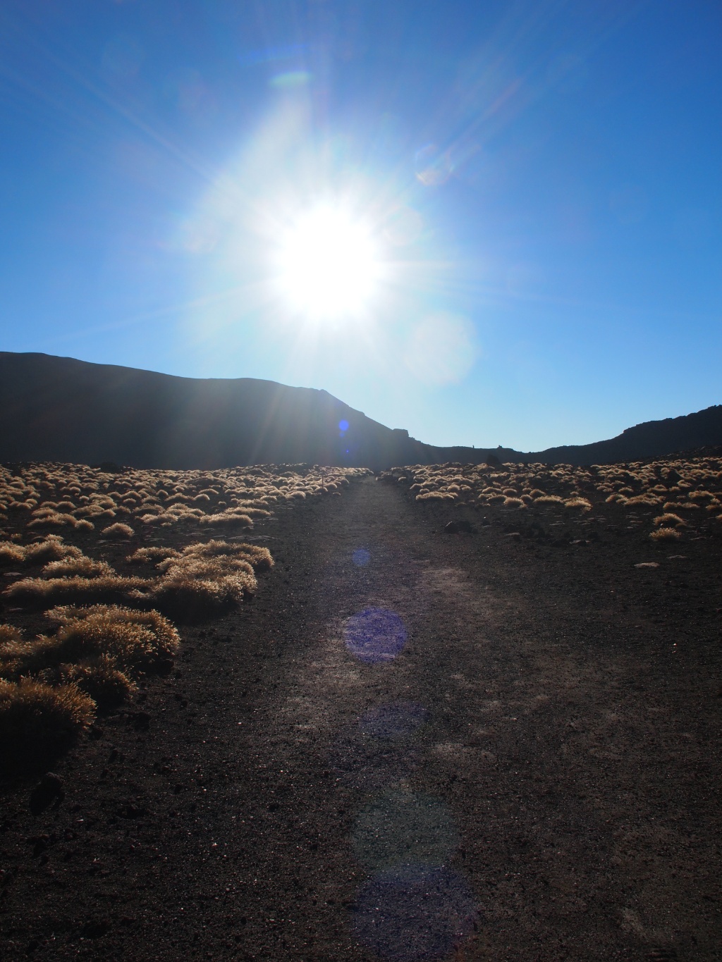
Already around 7:15 I started with the 20-km walk that normally takes up 5.5 to 8 hours. The first section is relatively flat, but then you have good two hours very steep climb ahead. Then again, there are flat sections between the volcanoes, in a landscape that is a mixture between the moon and the desert.

landscape synthesizer

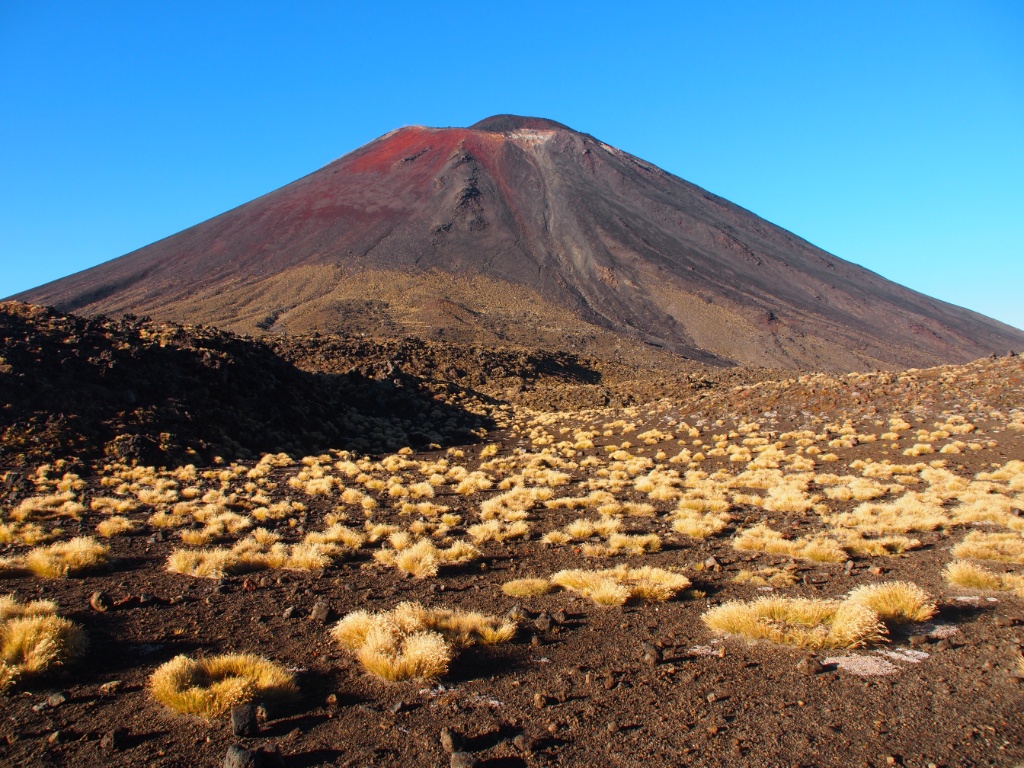
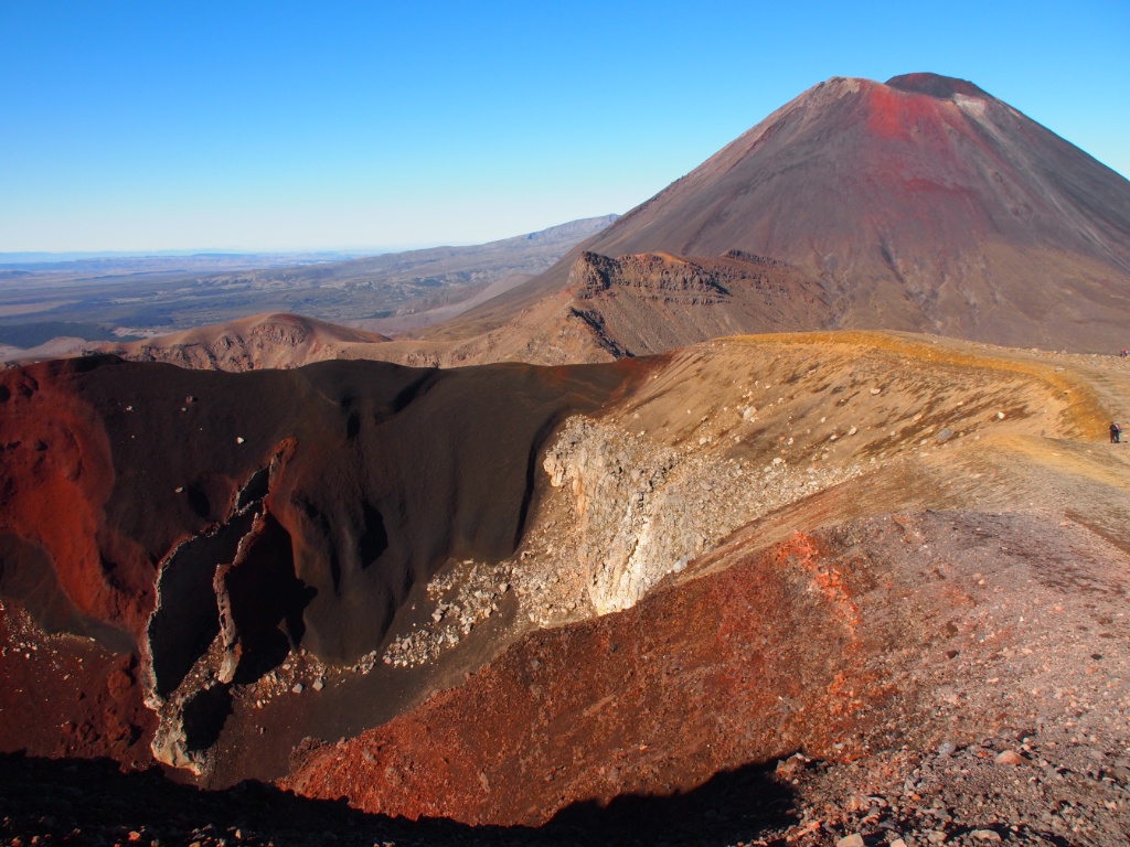
Star of the whole hike is Mt Ngauruhoe, a perfectly shaped active volcano that as Mt Doom was made famous in Peter Jackson's "Lord of the Rings".

Mt ngauruhoe

Krater Ngauruhoe

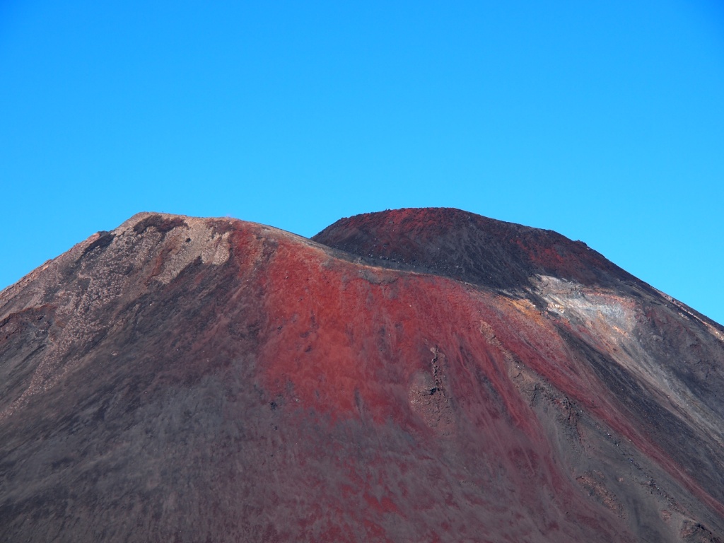
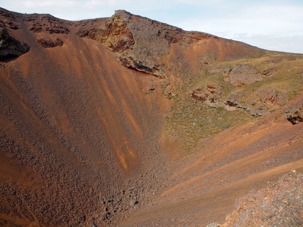
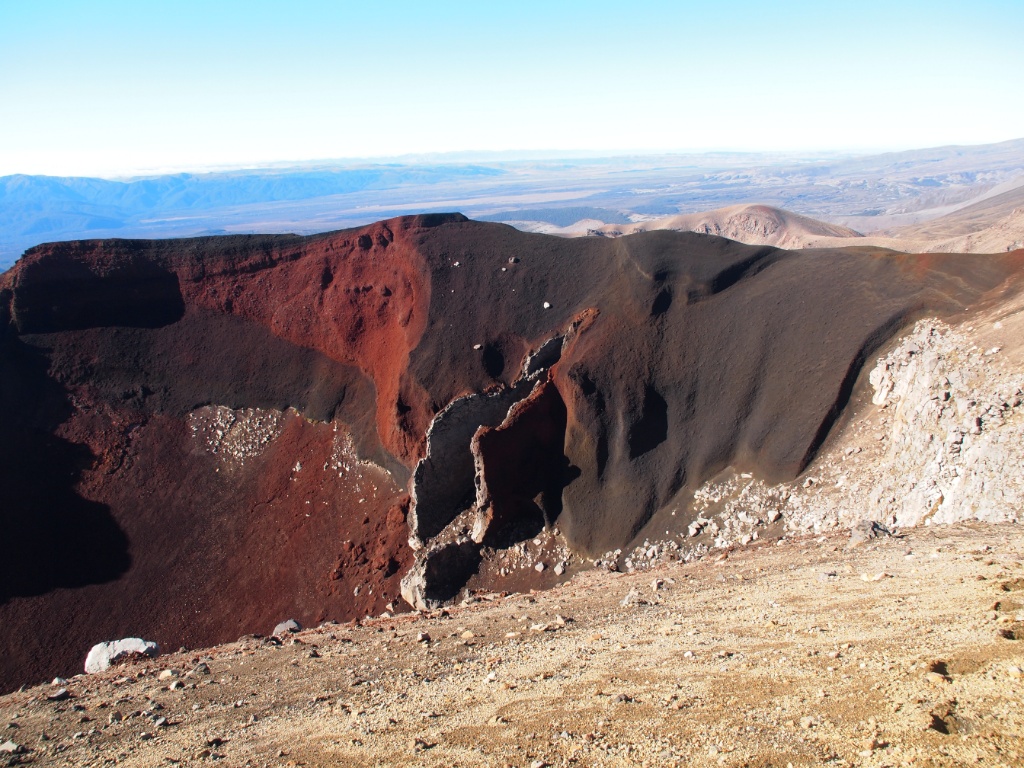
The next highlight was the Red Crater, of the Black offers a unique play of colors with its mix of reds.

Red crater

Red crater ngauruhoe

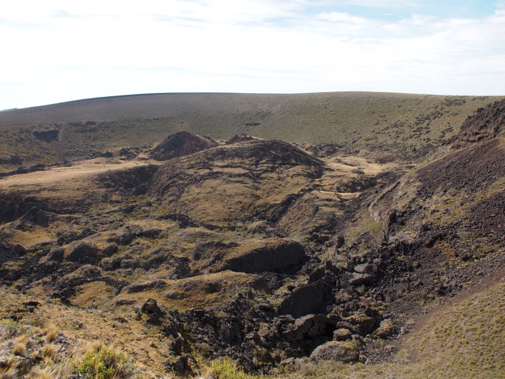
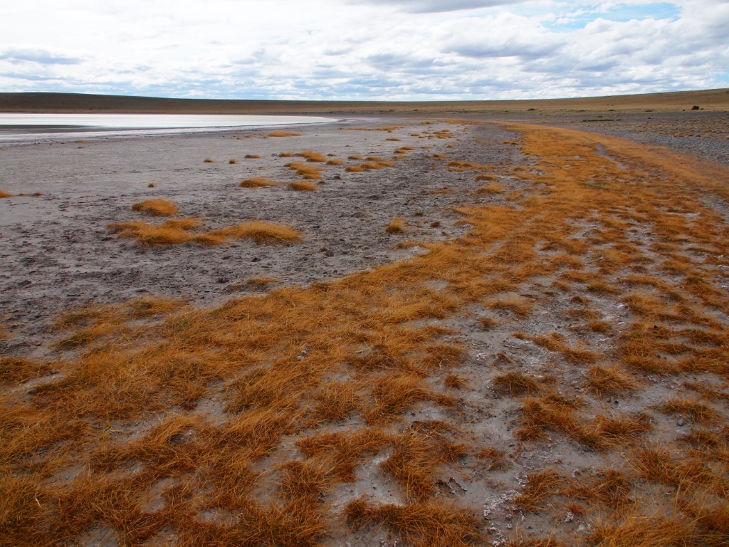
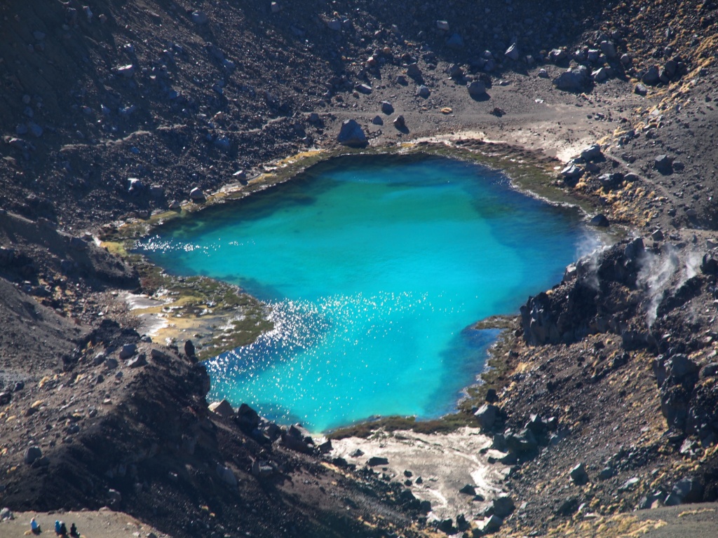
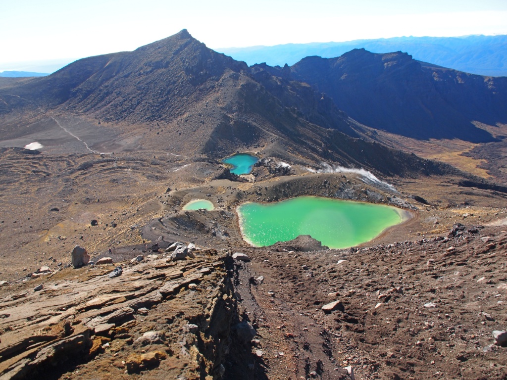
Although one is very much taken at this point of the hike, I compensated the views of the Emerald Lakes for it. Around the lake there are still places where regular sulfur vapor rises to the surface.

Emerald lake

Emerald lakes tongariro alpine crossing

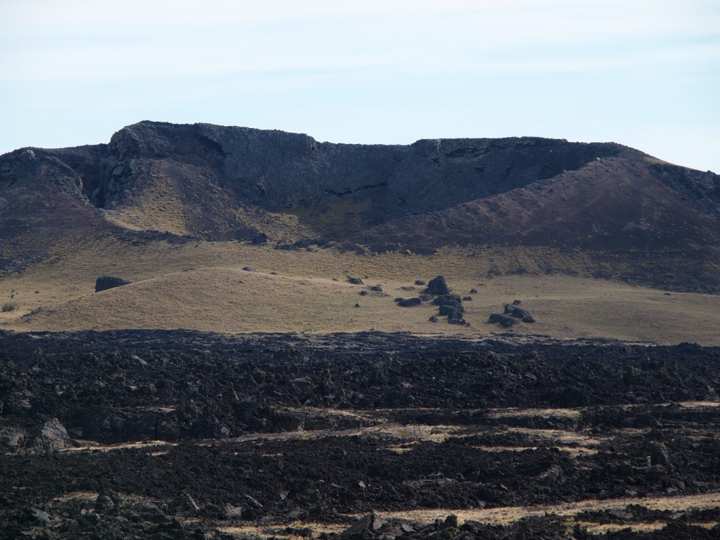
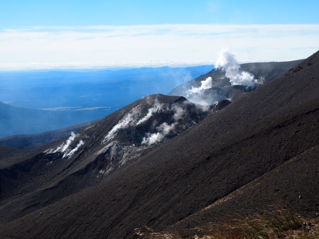
Even the lava field of the last outbreak is impressive and holds one of this as quickly as possible to move on, since there are active volcanoes 😉

Lavafeld ngauruhoe

Warnschild vulkan

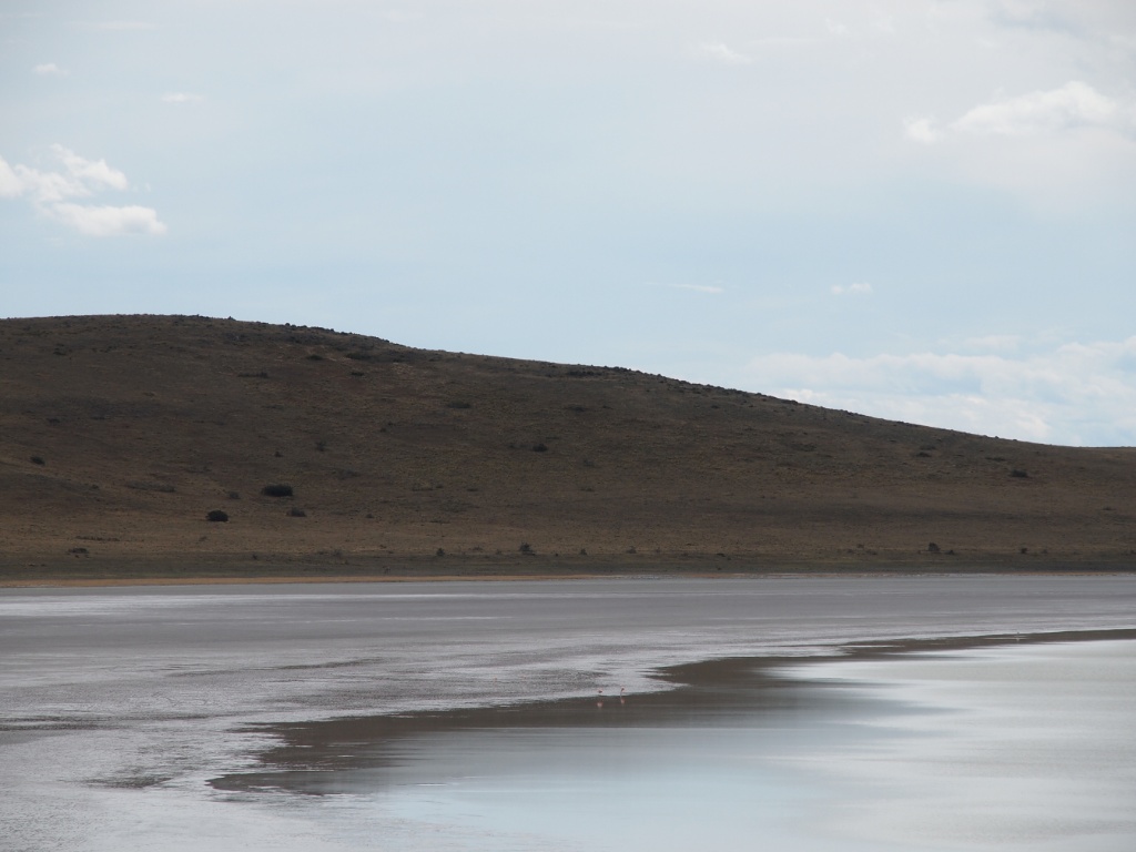
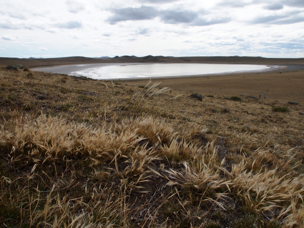
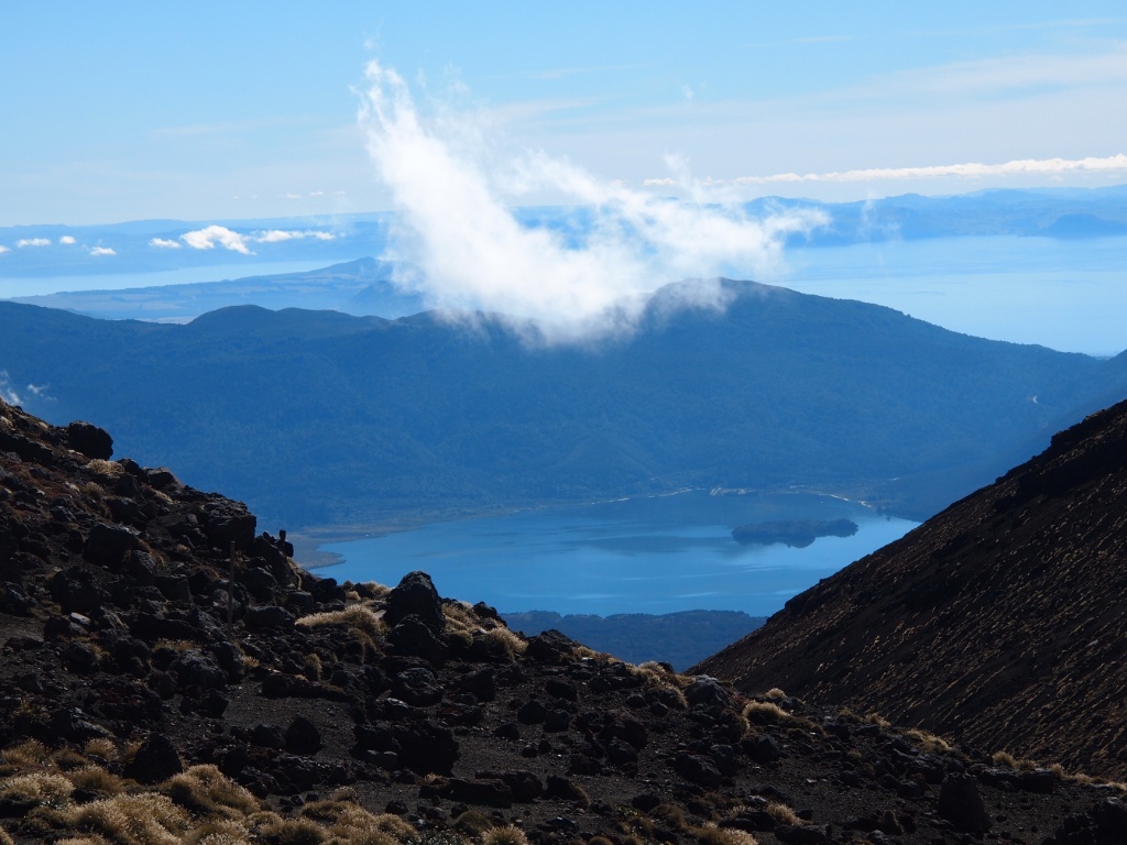
Then I finally arrived where it then only went downhill and I had a beautiful view of the Lake and the surrounding Rotoaira sulfur fields.

Aussicht lake at the Ira

Active volcano zealand

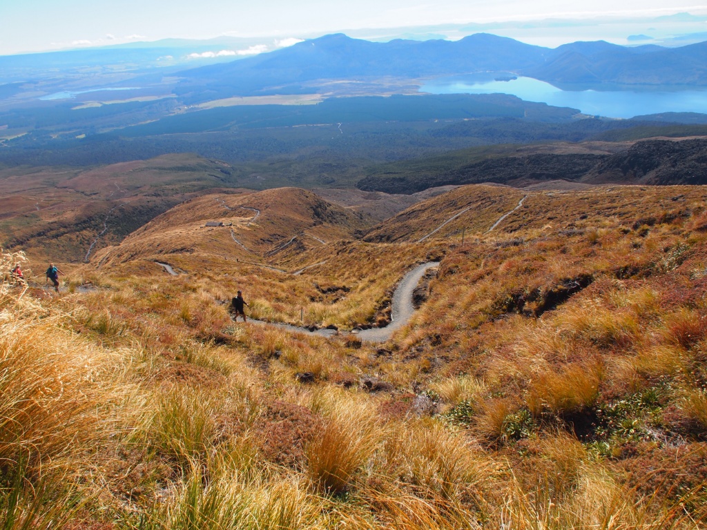
But the hike was not over yet! Eternally Long serpentine were to blame, that the descent really seemed endless!

Tongariro crossing wanderweg

Although the scenery was very impressive, I would not say that it is the most beautiful day hike in the world, perhaps the most beautiful of New Zealand, because although I have almost no made a hike in the Austrian Alps with green meadows and forests is safe varied 😉

Nationalpark Pali Aike

This National Parks located about 2.5 hours north of Punta Arenas and is accessible by day trip. Pali Aike literally means Devil's Country, which is due to the numerous volcanoes in the area. Here you walk in the lava fields directly on the Argentine border.

pali aike vulkan

Die Vulkan von Pali Aike

The youngest volcano is "only" to 15 million years and 9 by its red color.

pali aike

The special feature of the volcanoes is that they are unlike other not so high, and many even sunken crater like this have a diameter of 2 kilometers has.

pali aike

The crater Morada del Diablo is reached via a rocky road, the view of the colored stone masses very impressed.

volcanoes chile

Ana Laguna Die

near the crater there is a beautiful lagoon, which is also home to a couple of flamingos.

lagune pali aike

laguna ana

pali aike lagune

Pali Aike Tierwelt im Nationalpark

Like almost everywhere in Patagonia guanacos are ubiquitous and running on the run from the car either along the roadside or browse if you are traveling on foot peacefully in front of him.

guanacos pali aike

guanakofamilie

Very well camouflaged, these lizards who like to hide under del lava and are difficult to photograph.

echse pali aike

The park is also frequently encountered is the Camacho or Caracara, a very graceful Greifvoglel.

greifvogel pali aike

raptor flight

On the way back we stopped briefly in a ghost town where a disused ship, the first steamboat of the region is stored on the beach.

amadeo schiff

Even though this is a geologically interesting park is, compared to other volcanoes which I visited during my trip around the world that are in the Pali Aike Parque Nacional very little spectacular and the long drive through the region of Magallanes probably not worth it.

Vulkane Poas und Irazú

Excursions to the volcanoes

In unseren letzten zwei Tagen in Costa Rica, wollten wir in zwei Tagesausflügen von der Hauptstadt San Jose aus zwei Vulkane der Umgebung erkunden. Es war zu Beginn trotz Karte vom Tourismusbüro gar nicht so einfach herauszufinden wo genau die Busse abfahren, doch mit etwas Geduld und guten Spanischkenntnissen haben wir es dann doch geschafft!

After a tiring bus journey of 3 hours we reached finally the peak of the first volcano, the Poas, which is 2704 meters high and 1953 is the last time erupted. As before, a smelly sulfur from the crater cloud rises, it is however compensated by the view.

Vulkane Costa Rica

On a 60 minute scenic walk through a grove of trees to get past the beautiful Botos Laguna, just green shimmers in the sunlight.

Direkt am Eingang gibt es ein interessantes Visitor Center mit einem netten Geschäft für Souvenirs und Sanitäranlagen. Wie fast überall in Costa Rica ist alles sehr gepflegt sodass man gut versorgt ist.

Lagune Vulkan Poas

Ohne Rast und ohne Ruh ging es dann am nächsten Tag weiter zum zweiten Aussichtspunkt.

Mit 3432 Metern ist der Vulkan Irazu der höchste in Costa Rica der seit dem 18. Jahrhundert 15 Mal ausgebrochen ist. Schon bei der Busfahrt kann es einem aufgrund der Höhe relativ schwindelig werden, obwohl die Straße wirklich nicht sehr steil und breit gebaut ist. Gott sei Dank wir am Hinweg ein kleiner Stopp in einem Souvenir- und Snackshop eingelegt, sodass man auch den Höhenunterschied etwas besser wegsteckt.

Krater Irazu

The crater of the Irazu Volcano is 1050 meters wide and 300 meters deep. The landscape around the volcano is impressive, especially the view down to the city of Cartago, or when fill the valleys with clouds.

Kraterlandschaft Irazu

landschaft costa rica

Ausblick Irazu

After a short but due to the amount strenuous climb to the lookout point, we have our snack really deserves, at least we thought ..... but we did not expect the hungry anteaters, has made us a Stricht by the bill! Na meal!

Ameisenbär Costa Rica